|
|
![]()
The basic components of geographical information
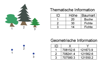
A commercial GIS stores spatial data and its attributes in separate data files in which corresponding lines are linked by a unique identification number. This identification number allows a GIS to search for attribute values and to display them based on spatial query criteria, and vice versa.
In the geometric representation of an object, information about its attributes can be derived by selecting this object in a GIS. There is also the possibility to identify an object by its geometric representation by selecting its entry in the attribute table.
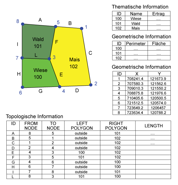
The data structure comprises the connection of thematic and geometric information. The geometry is expressed in the spatial reference. A spatial reference is assigned to all the objects in a greater or lesser extent. Spatial references describe the location and extent of this geographic information. In addition to the metric properties (geometry), topological properties should also be mentioned. Topological properties are expressed by information about e.g. relations of neighborhood (what object is neighboring?), containedness (does an object contain other objects?), overlap (is an object overlapped by other objects?), etc. In addition to geometric and topological properties, thematic properties are also assigned to each object. They are stored in tables. The geometric and thematic information affect each other. These so‐called objects are subject to temporal changes. (Bartelme 2000).
 Fig. C: Basic components of a GIS
Example 1:
Example 2:
|
|
|
|