|
|
The information system
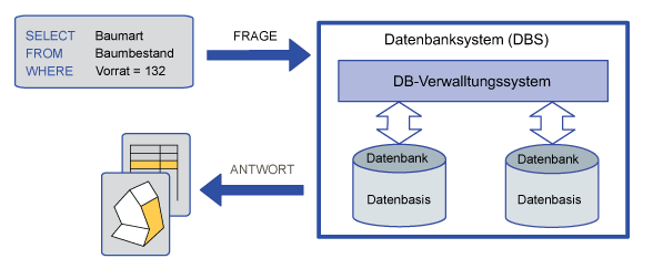
An information system is a question‐answer system based on a data set. This system contains tools for the computer based analysis and handling of information. Such a system is called geographic information system (GIS) if the data are geographically referenced (Carosio 2000). A GIS is composed of various individual components. Some of these functions are basic, while others are more complicated or required for special applications. The user interface, query functions and the data management system play an important role. The user interface enables the user to communicate with the system. It allows users to start operations, query information, etc. Via the user interface, analysis functions can be executed through accessing the data. Data access and data management in general is controlled by the database management system.
Have a look at the following illustration to get an
idea of information systems:
 Fig. A: Architecture of a database
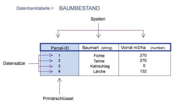
 Fig. B: Structure of a table