|
|
Unlimited analysis of distance relations
This unit is dedicated to the analysis of distances between spatial objects. Unrestricted means that no spatial restraints
(such as transport network, topography or settlement area, which could constrain the spatial distance between objects) are
taken
into account. If information is missing, it can be very useful to perform the analysis without predefined conditions.
The term proximity is quite imprecise. It can be replaced with more qualitative terms such as "near", "far" or "in the neighborhood
of". The term "proximity" has to be objectified and operationalized in order to use it in a GIS. For this reason, a distance
concept
is needed, such as the Euclidean distance or the travel time (cf. unit 1 Space, Object and Distance Relation). In the second
step,
the unit for "proximity" has to be defined interpretatively. There exist more appropriate and less appropriate units, but
none of
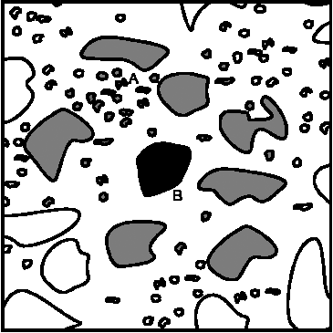
them is right or wrong. It is therefore important that the neighborhood relations are well and reasonably defined. Illustration
1
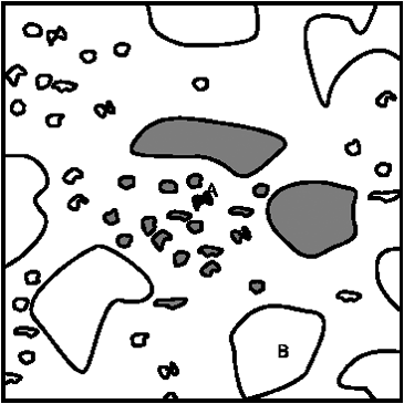
object B is large, and its neighborhood is mainly determinate by large objects. Object A (illustration 2) is smaller and
located
in a different neighborhood, mainly determined by local and small objects. It is evident, that A belongs to the local environment
of B, B be is not necessarily part of A’s environment.
 Distanz und Nähe ist kontextabhängig und nicht symmetrisch (Worboys 1996)
 Distanz und Nähe ist kontextabhängig und nicht symmetrisch (Worboys 1996)
In the proximity analysis and the analysis of neighborhood, the catchment areas and areas of influence related to supply and demand are of interest. Frequent questions in this context:
- Which and how many pharmacies are located within a radius of 300m from a specific location?
- Which are the catchment areas of shopping centers?
- How many households are reached by the transmission power of a mobile phone antenna?
- Is a certain district located within the noise zone of the highway?
