|
|
What are the Objectives of Thematic Maps?
Definition
The International Cartographic Association defines the thematic map as follows: „A map designed to demonstrate particular features or concepts“. Thus, in conventional use, this term excludes topographic maps. The base maps of most thematic maps, however, contain topographic elements.
Composition
Every thematic map is composed of two important components: the geographic base map and the thematic overlay. The purpose of the geographic base map is to provide information about the location to which the thematic overlay can be referred.
Examples of „Specially Ordered“ Maps
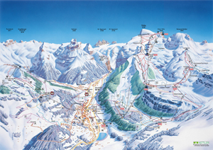
 Engelberg Ski Resort 2002 (Engelberg-Titlis Tourismus AG) Engelberg Ski Resort 2002 (Engelberg-Titlis Tourismus AG) |
We find good examples of thematic maps in tourism: bicycling maps, museum maps, or maps of skiing resorts.
|
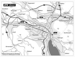
 Map for students orientation support for ETH Zurich 2002 (Institute of Cartography) Map for students orientation support for ETH Zurich 2002 (Institute of Cartography) |
Other "special" thematic maps are e.g. transportation and communication maps, such as transport systems or station locations. In the next example, we can see a part of the transport network of Zurich city, stacked on a geographic base map. This map allows orientation for accessibility of the university by public transport for ETH students. |
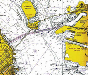
 Nautic chart: From San Francisco to Oakland, 1992. (Makower 1992) Nautic chart: From San Francisco to Oakland, 1992. (Makower 1992) |
Maps which are specially designed for the needs of nautical and aeronautical navigators, are called charts. On charts, navigators plot their navigation courses, determine positions, mark bearings, etc. |
