Construction of geographic information
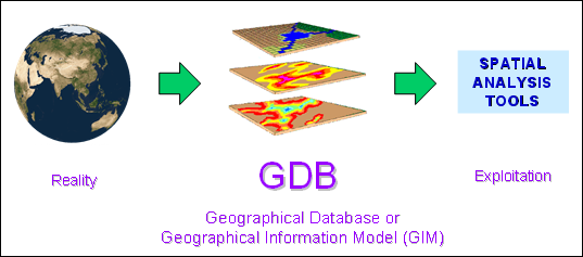
It is a long way from the reality to a geographic
information model (GIM).
|
From the reality to a geographic information model
|
|
Modelling the reality (B-SM)
What to retain from the complexity of reality?
Anything relevant to the objectives of the study, but in a structured way.
|
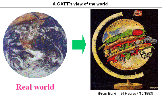
From the real world to a model of the reality
|
|
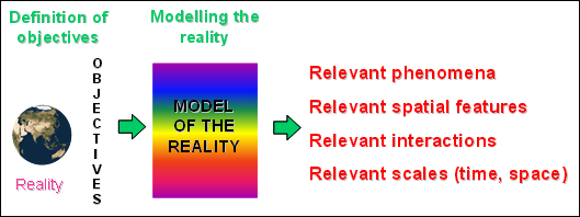
What are objectives of the study?
To answer to this obvious but tedious question, one should identify:
- The objectives of the exploitation
- All phenomena involved
- Concerned spatial features according to the spatial scale of investigation
- Concerned time-span: static or dynamic
|
Objectives of spatial analysis
|
|
How concerned elements of the reality can be
organised in a structured set?
This leads to the definition of information content and its structure:
- Type of spatial units of description (measurement):
predefined units (objects in object mode) or arbitrary units (cells in image mode)
- Identification of spatial units: individual objects
or definition of cell size (resolution)
- Richness of thematic content: relevant indicators, level of measurement
- Richness of time content: period of investigation, time intervals
Collecting data from the reality (B-DC)
What are available sources of data for the production of a
relevant model of geographic information (Geographic Database, GDB)?
To answer to this complex and time consuming query, one should identify and verify:
- Adequate sources: with thematic, geometric and time contents
- Source types: terrain, documents, existing GDB
- Relevancy of information content: thematic, geometric and time contents
- Quality of information content: thematic, geometric and time contents
How to design a methodological process to collect and to
produce relevant numerical data?
Data collection and production of numerical data require knowledge and expertise
about the nature of the source and the phenomenon:
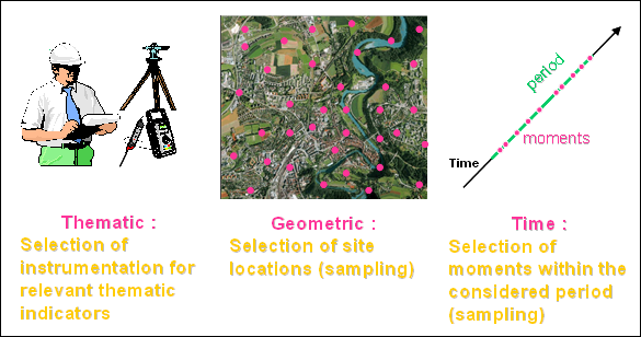
- Acquisition instruments and specific techniques
- Data sampling procedures for representativeness
- Data digitising methods to produce numerical data
|
From terrain to geo-data: Set-up of acquisition procedure
|
|
Conditioning and regionalising data (B-AN, Lessons 2 to 4)
How to produce a relevant model of geographic
information from the collected set of data?
Sampled data sets do not fully express the distribution of phenomena
properties throughout space and time. They have to be conditioned to
become Geographic Information, an expression of the model of reality:
- Deriving significant indicators from collected variables
- Estimating individual properties of spatial units (objects or cells)
based on sampled locations: Regionalisation
- Estimating properties of time series from the original sampled time interval
Organising and managing Geographic Information (B-DM)
How to efficiently organise Geographic
Information (GDB)
for reliable updates and fruitful exploitations?
The geographical database should be organised and structured in a
way that allows safe and reliable maintenance and a multidimensional
access to information for its exploitation:
- Maintenance of the meta-information
- Control of GDB integrity
- Planning updates of phenomena properties and their
related spatial entities
- Allowing access to information for multiple types of exploitation


