|
|
Mapping with GIS and Cartographic Software
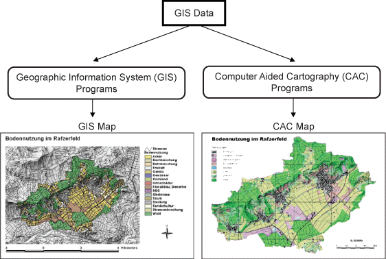
Cartography predates the invention of Geographic Information System (GIS) by thousands of years. Up to 10 years ago, maps were made by professional cartographers, who had the time and the need to carefully plan where each map feature would be placed and consider the visual impact of the map. Nowadays, progression in GIS and Cartography software technology have converged in a suite of truly open and flexible tools which reduce time for map and chart production from days to hours, including for non-cartographic specialists. We will see in this lesson, why the map outputs from GIS are not always optimal, and learn the main advantages and disadvantages of Computer Aided Cartography and Geographic Information System for mapping purposes.
 map source: student work at IKA, ETH Zurich
Learning Objectives
- Learn the differences between the various kinds of existing digital cartographic software.
- Learn which software is right for specific purposes.
- Know the capacity and limitations of GIS for cartographic presentation.
