GITTA-Logo
PDF Version of this document Search Help

Lesson Navigation IconOverview of sources and methods

Unit Navigation IconTypes of source materials

LO Navigation IconGIS Data Sources

LO Navigation IconShare your findings

Unit Navigation IconQuality and Coverage of Data Sources

Unit Navigation IconBibliography

Unit Navigation IconMetadata


GITTA/CartouCHe news:


Go to previous page Go to next page

GIS Data Sources

Click on the buttons to view the complete animation.

Visit these Web Pages

act

1. Visit the following web pages, indicate the sources and links to GIS Data. The first 5 links, which are mandatory links, , provide detail on data sources of Switzerland.

The following optional links provide global, regional and national level data sources for various applications.

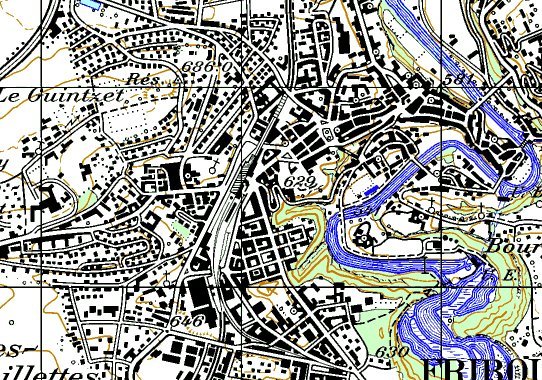
2. See the following paper map as an example of a data source.

Part of the Fribourg MapPart of the Fribourg Map

Data Research

act

1. Assuming that we want to analyze the impact of climate change to biodiversity at the global scale. According to the discussion, the following datasets are generally identified.

  • i.) Elevation data or Digital Elevation Data of the World
  • ii.) Vegetation Map of the World
  • iii.) Global Mean Annual Temperature
  • iv.) Global Mean Annual Rainfall
  • v.) Global Land Cover Map
  • vi.) Existing Protected Areas of the World
  • vii.) Global Sea level Data

Suggest available data sources for at least two datasets mentioned above.

2. Find out the scale of available Swiss National Maps. (Hint: Swisstopo.ch)

3. A telecommunication company require very detailed street level data to map the address of customers and to preliminary laid out the fibre optics network. Which dataset should be used?

Top Go to previous page Go to next page